Overview
This subject was introduced under Autonomy of the College, as a part of a Community-Based Projects initiative, where students worked on GIS-driven, real-world problem-solving projects addressing local civic, environmental, and social challenges.
The core objective was to move learning beyond classrooms by engaging students directly with communities through field surveys, data collection, geospatial analysis, and full-stack application development. Each project was designed to respond to an authentic community need and was explicitly mapped to one or more United Nations Sustainable Development Goals (SDGs).
All applications were developed using Java Spring Boot on the backend, with GIS-based visualization and dashboards to support data-driven decision-making.
Pedagogical Approach
The project followed a learning-by-doing and community-first methodology, where students:
- Conducted on-ground surveys and stakeholder interactions
- Identified local problems with measurable impact
- Collected and validated real-world data
- Designed GIS-enabled web applications
- Mapped project outcomes to relevant SDGs
- Focused on usability, accessibility, and social relevance
This approach helped students understand how technology can serve society while developing strong technical and analytical skills.
Project Themes & Applications
Students developed a diverse set of community-focused GIS applications, including:
Environment & Sustainability
- Air & Noise Pollution Monitoring Dashboard
- Community Tree Plantation & Green Cover Tracker
- Real-time Water Logging and Drainage Map
Public Safety & Emergency Response
- Trekking Trail Safety & Assistance Web App
- Smart Ambulance and Emergency Hospital Locator
- Disaster Alert and Evacuation Route Planner
- Blood Donation and Availability Tracker
Urban Infrastructure & Civic Engagement
- Open Civic Complaint Portal
- Public Toilet and Sanitation Facility Finder
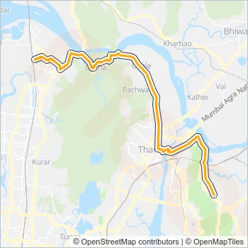
- Public Transport Route Visualizer
Social Development & Inclusion
- Accessible Places for Differently Abled
- School Dropout and Literacy Tracer
- Community Skill Directory and Freelance Platform
Data, Governance & Urban Studies
- Local Crime Heat Map and Reporting System
- Brick by Brick: The Real Estate Reality
Each project integrated geospatial visualization, dashboards, and interactive maps to improve clarity and decision-making.
Technology Stack
- Backend: Java Spring Boot
- GIS & Mapping: Spatial data layers, heat maps, route mapping
- Data Collection: Community surveys, field data, public datasets
- Visualization: Interactive dashboards and map-based interfaces
SDG Mapping
Projects were explicitly aligned with the UN Sustainable Development Goals, including:
- SDG 3 – Good Health and Well-being
- SDG 4 – Quality Education
- SDG 9 – Industry, Innovation, and Infrastructure
- SDG 10 – Reduced Inequalities
- SDG 11 – Sustainable Cities and Communities
- SDG 13 – Climate Action
- SDG 16 – Peace, Justice, and Strong Institutions
This mapping helped students connect technical work with global development priorities.
Learning Outcomes
Through this initiative, students gained:
- Hands-on experience with GIS and full-stack development
- Exposure to community-centered problem identification
- Skills in survey design, data validation, and analysis
- Understanding of technology for social good
- Ability to align projects with policy and sustainability frameworks
Reflection
This community-based GIS project demonstrated how technology education can be socially grounded and impact-driven. By combining fieldwork, geospatial analysis, and software development, students learned to build systems that are not only technically sound but also ethically responsible and socially meaningful.
The experience reinforced the importance of context-aware computing, civic responsibility, and sustainable innovation in technical education.